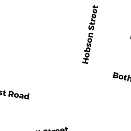
47 HOBSON ST
Owner Information
CAHILLANE TRAOLACH
40 PRESENTATION RD
BRIGHTON, MA 02135


Property Details
47 HOBSON ST is classified as a Two-Family Residential (Conventional).
The primary structure on this property was built in 1900. There is 2,948ft2 of residential/living space within this property. This property is listed as having 13 rooms.
47 HOBSON ST is valued at $886,500. The land is valued at $245,100 and the structures are valued at $641,400.
The most recent deed for 47 HOBSON ST is recorded at the local registrar in Book 41407, Page 215. 47 HOBSON ST was last sold on Tuesday, March 6, 2007 for $575,007.
Assessment data from fiscal year 2020.
Flood Data
According to the FEMA National Flood Hazard Layer, this property does not appear to be in a flood zone. It may also be in an area not yet reviewed. Nonetheless, confirm this information prior to taking any action.
To view the flood hazards around this property, create a FEMA "Firmette" Map of the area around 47 HOBSON ST.
Broadband Internet Providers
| Provider | Type | Bandwidth (mbps) | |
|---|---|---|---|
| Comcast | Cable | 1000 | 35 |
| Verizon New England Inc. | Fiber | 940 | 880 |
| Starry, Inc. | Fixed Wireless | 200 | 200 |
| VSAT Systems, LLC. | Satellite | 2 | 1 |
| GCI Communication Corp. | Satellite | 0 | 0 |
| HughesNet | Satellite | 25 | 3 |
| Verizon New England Inc. | DSL | 10 | 1 |
| Viasat Inc | Satellite | 100 | 3 |
| RCN | Cable | 1000 | 20 |
| RCN | Cable | 500 | 20 |
Broadband service provider data from December 2020.
Adjacent Properties
- 6466 DONNYBROOK RD
Two-Family Residential owned by PRINCE JAMES F - 4749 NEWCASTLE RD
Three-Family Residential owned by MCLAUGHLIN MARY ELLEN - 43 HOBSON ST
Other, Open Space owned by FORTY-3 HOBSON STREET - 43 HOBSON ST 2
Residential Condominium owned by KAEMPFE SCOTT A - 43 HOBSON ST 3
Residential Condominium owned by CHIO AARON H - 43 HOBSON ST 1
Residential Condominium owned by SILVERS STEVEN - 51 HOBSON ST
Other, Open Space owned by FIFTY 1 HOBSON STREET - 51 HOBSON ST 1
Residential Condominium owned by MASELLI SUZANNE - 51 HOBSON ST 2
Residential Condominium owned by BENNETT DUSTINA M